Legend
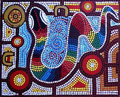
Aboriginal legend says that the Murray River resulted from the journey of the rainbow serpent in search of his tribe. On his way there, he made the mountains and hills. When he found them, he danced until late, eventually falling asleep. The people from the flat country followed the rainbow serpent. Two boys looking for a place to sleep mistook his mouth for a cave. The rainbow serpent left the hills before the missing boys could be discovered. Eventually hunters found him and slit open his belly. The boys, who had now turned into parakeets flew out screeching! Waking to find himself cut open, the rainbow serpent shook the mountains and the hills with rage. Rocks flew towards the people and as they fled, they turned into all manner of plants and animals. Eventually the rainbow serpent tired and escaped into the sea, leaving the aboriginal people to look after their brothers and sisters.
The snake's track describes the way the Murray moves through the landscape, in long, snaking meanders, but also the billabongs that surround it - remnants of earlier paths. His journey into the mountains fits with the magical perched upper Murray valley, hidden in the foothills of the mountains, which it enters through a narrow gorge-like track. Its escape into the sea fits with the cliffs which held the Murray back for many thousands of years in the lower valley, but through which, it also eventually found its way to the sea.
Geography
The Murray River has three major sections, known as the Upper, Middle and Lower Murray.

The Upper Murray is montane. Here the river begins as a mountain stream, swelling with each successive tributary from the numerous gorges and valleys of the North-Western slopes of the Snowy Mountains. As the river broadens, so too does the valley that it drains. With Mt. Kosciusko at its head and bounded by ranges on either side, the Upper Murray meanders through it every widening valley, building river flats and pebble shoals. It is an exceptionally pretty landscape, greener than many surrounding areas due to a higher than average rainfall and only sparsely settled owing to its relative isolation. Just as the river seems to be establishing itself, the valley closes and the river enters the hills once again. These hills mark the end of the Upper Murray. As the river emerges, it runs into the Hume Dam, a large shallow reservoir also fed by the Mitta Mitta River.

The Middle Murray is characterised by wide open plains. Between Albury and Mildura the river flats are broad and made up of finer clay sediments than its faster flowing mountain predecessor. The river gradient decreases to around 3 cm a kilometre and the current slows. Pebble reaches are replaced by sand bars and floodplains dominated by clay soils. Around Cobram, the beaches are particularly large, however they are more modest once the river enters the River Red Gum Forests after Tocumwal. All the major tributaries in the first part of the Upper Murray drain the Victorian section of the Great Dividing Range. It is not until well after Swan Hill that the Murrumbidgee and Darling Rivers enter from the North, contributing water from Central Eastern Highlands of New South Wales and monsoonal South West Queensland. At times, the river follows its ancient bed, however it has one other defining feature - the Cadell fault. From 75,000 to 20,000 years ago a series of uplifts raised a triangular block of land between Echuca, Deniliquin and Swan Hill, blocking both the Murray and Goulburn Rivers and forming large lakes. The iconic Barmah-Millewa River Red Gum Forest provides some indication of the lake's original size, marking the extent of the seasonal floods which this forest depends on to remain healthy. Even today, the Cadell fault restricts flow down the Murray, diverting water in a series of braided streams through the forest, North past Deniliquin into an anabranch, the Edwards River, or south through the Barmah choke which broke into the Goulburn. When the river is high, more water flows through the Murray's northerly branch, the Edwards River, than via the choke to Echuca, watering the Red Gum Forest in the process. As the river approaches Mildura and the South Australian border, it cuts through red sand dunes, remnants of a retreating sea shoreline. This mallee landscape signals the end of the Middle Murray.

The Lower Murray famously winds its way between tall golden limestone cliffs. These are not omnipresent, but they continually re-appear and around Waikerie, reach nearly 80 metres in height. This area of the Murray has been frequently inundated by the sea: fossil shells and other evidence of its marine past can be easily found amongst its strata. Hollows in the cliffs, caused by water and wind erosion provide habitat and shelter for birds, lizards and small plants. Lines high in the cliffs are evidence of mega floods from wetter periods in our continent's history 10 to 15 metres higher than those during European settlement. Restricted by the uplifted landscape it flows through, the Murray seems to contort, bouncing from one side to the other, leaving behind wetlands full of water birds and lush pockets of vegetation. Towns like Mannum, Morgan and Blanchetown have imposing views over the river landscape. Once the Darling enters the Murray at Wentworth, the Murray's colour changes from a light brown-green colour to a milky grey. It is in the Lower Murray that the river suddenly changes the West-North-West course it has followed for most of its 2,700 kilometre journey and is finally able to head South to the sea. For the last 100 kilometres the river is wide and sluggish. Everything is bigger, straights and bend (reaches) can continue for over 10 kilometres. The river gradient decreases further, dropping only 1 cm per kilometre. Lake Alexandrina and the Coorong, the last features before the Murray reaches the ocean, form a landlocked delta, which the river fans out in and feeds, depositing its nutrient-rich sediment from throughout the Murray-Darling Basin. Now controlled, the river may have had multiple, changing mouths which flushed out the Coorong during seasonal floods. It is a haven for water-birds. Seeing these in their hundreds and thousands at dawn is an unforgettable experience. The Lower Murray ends as it reaches the sea. For most of the time, this is a peaceful experience, the Murray, its energy spent enters the sea as a gentle current.
Geology
The Murray is an ancient river. It existed before Australia adopted its current shape. It formed when the mountains of the Great Dividing Range in the south-east of the continent were uplifted 100 million years ago as part of the breakup of the southern supercontinent Gondwana, forcing the ancient streams to reverse their direction and begin a much longer, westward journey to the sea.


Foothills of the Great Divide in central and western Victoria fed the river through northerly flowing streams and blocked its passage south. In a much warmer period than today, when sea levels were 80 metres higher than now the mouth of the river was between Swan Hill and Echuca, (sediments from its delta have been found near Kerang). There were many periods of inundation by the sea, especially in the lower Murray downstream of Mildura, leaving saline subsoils and sandhills. Some marine sediments (Pinnaroo block) were uplifted to form the majestic cliffs of the lower Murray. Reaching 80 metres in height, these cliffs blocked the Murray for a time, to form Lake Bungunnia between Chowilla and Robinvale, and diverting the Murray south towards Portland as its overflow. Erosion of the block by a stream on the seaward side and uplift of the Grampians blocking the overflow channel finally breached the Pinnaroo block and the Murray carved a new path to the sea through Murray Bridge where it flows today.
 |
| Holgate & Gallagher 2003: Tertiary Basins of Australia. |
 |
| Bowler, J.M., Kotsonis, A. & Lawrence, C.R., 2006. Environmental evolution of the Mallee region, Western Murray Basin. Proceedings of the Royal Society of Victoria 118 (2): 161-210. |
The Murray River owes extremely low gradient (averaging 3 cm per km) to movement of the Australian crust following the breakup of Gondwana (between 180 - 45 million years ago). The Murray basin is basically a downwarp: as land in the middle of the basin subsided, land to the East and West was raised. In the west, the Mount Lofty Ranges (near Adelaide) blocked the westward passage of the river forcing it south, but also held back sediment. The northern plains of Victoria and Riverina of New South Wales have sediments deposited by the Murray and its tributaries that are over 100 metres deep in places. The expanse and depth of this sedimentary plain explains why the landscape is so flat: few features protrude through its thick blanket.

 |
| Source: VEAC Investigation Paper on Victoria's River Red Gum Forests. 2008 Report. modified after Rutherfurd and Kenyon (2005); Barberias (1983). |
Later uplifts along old Gondwana faults guided the river north and south (see Tertiary Basins of Australia diagram) but one, the Cadell Fault blocked it in recent times. Beginning about 75,000 years ago a triangular block of land began to be uplifted between 12 metres near deniliquin tapering to 3 metres near Rochester, diverting the river north and forming the Edwards River. Around 32,000 years ago, one of these uplifts blocked the Murray (forming the Old Barmah Lake on whose edge Picnic Point Caravan Park is situated) and the Goulburn River (forming Lake Kanyapella). The lake drained 18,000 years ago when the Goulburn River broke through the fault at Echuca, leaving behind fringing 20 metre sandhills on the road into Barmah as witnesses of its past size.
References:
Andrew, J, & Marsden, M. (eds). 1973. Regional Guide to Victorian Geology. University of Melbourne 1973 Second Edition.
Birch, I. & William D. 2003. II. Geology — Victoria, Australia. Geological Society of Australia; 23.
Bowler, J.M., Kotsonis, A. & Lawrence, C.R., 2006. Environmental evolution of the Mallee region, Western Murray Basin. Proceedings of the Royal Society of Victoria 118 (2): 161-210. ISSN 0035- 9211.
Costermans, L. Guide to trees and shrubs of South Eastern Australia.
Douglas, Kirsty. 2010. Pictures of Time Beneath: Science, Heritage and the Uses of the Deep Past.
Holdgate G.R., K.A. Cunningham, M.W. Wallace, S.J. Gallagher and D.H. Moore, 2003. Tertiary ‘deep lead’ palaeoriver systems and their relationship to basin evolution, Victoria. PESA Eastern Australasian Basins Symposium II Adelaide, 20 – 22 September, 2004.
How the Murray River Was Formed. http://www.murrayriver.com.au/about-the-murray/how-the-murray-river-was-formed/
Kingham, R. 1988. Geology of the Murray-Darling Basin — Simplified Lithostratigraphic Groupings. Geohazards, Land and Water Resources Division, Australian Geological Survey Organisation, GPO Box 378, Canberra, ACT 2601.
McAndrew, J. & M. Marsden. (eds). 1973. Regional guide to Victorian geology. School of Geology, University of Melbourne.
McPherson, A., D. Clark, M. Cupper, C.D.N. Collins and G. Nelson. The Cadell Fault: a record of long-term fault behaviour in south-eastern Australia. Australian Regolith and Clays Conference Mildura 7-10 February 2012.
Murray Basin http://en.wikipedia.org/wiki/Murray_Basin
Murray River http://en.wikipedia.org/wiki/Murray_River
Rainbow serpent Youtube: http://youtu.be/pCuuRRrfOXo
Stewart, A.J. Year: 2011 www.pir.sa.gov.au/minerals/geology/south australian basins/cainozoic basins
Stone, T. (20007). The late-Holocene origin of the modern Murray River course, south-eastern Australia. Elsevier;
Stone, T. (2006). Late quaternary rivers and lakes of the Cadell Tilt Block region, Murray Basin, southeastern Australia. PhD thesis, School of Earth Sciences, The University of Melbourne.
Victorian Environment Assessment Council. (2008). River Red Gum Forests Investigation. Discussion Paper: Part A: Environmental, Social and Economic Setting (pdf).

No comments:
Post a Comment