Showing posts with label wilkinson's cutting. Show all posts

Day 22: 602 to 566 km to the sea: Wilkinson's Cutting - Renmark.


Day 22: Sunday 9/12

Wilkinson's Cutting - Renmark
River markers: 602 to 566 km from the sea.
Distance travelled today: 36 km. 
Total distance travelled: 1148 km


Day 22: campsite at dawn: Wilkinson's Cutting. — at Wilkinson's Cutting.


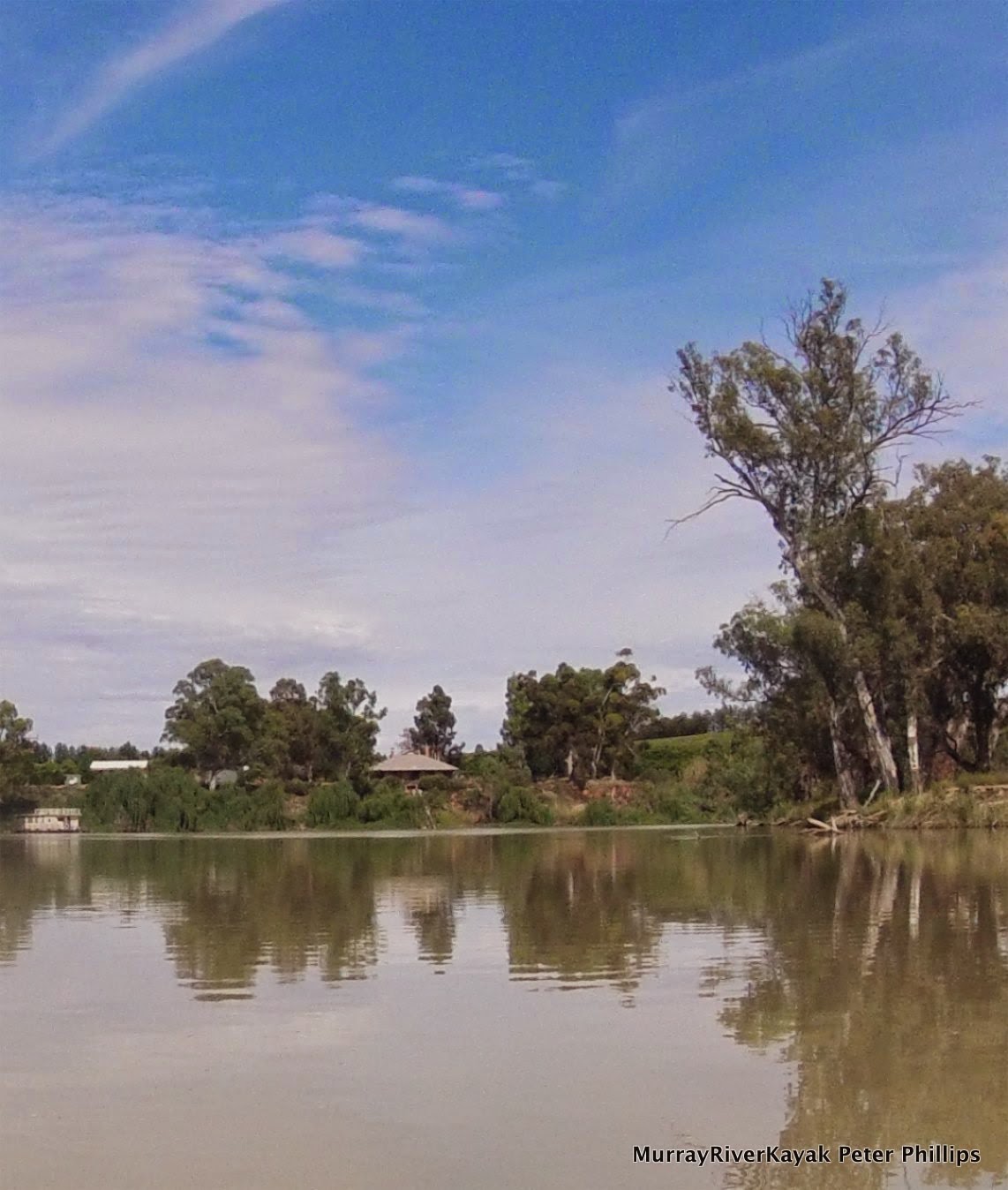
Another early start today hoping to avoid any winds that might develop and also to enable me to get as much out of the day in Renmark as possible. I packed camp, took the time to have a civilised shave and a cuppa tea and hit the water at 6:36 am. The sun had just risen over the cliffs of Wilkadene Station and shed the golden light that is so wonderful at this time of the morning on the water. It was virtually wind still, which meant that as I paddled off, my wake formed geometric waves, which themselves caught the light behind me.

I had hardly gone a kilometre though when conditions began to change. The thunderstorms which were predicted for last night may not have eventuated, but now here came the southerly change. It built quickly from a fresh breeze into a strong gusty wind. It seemed to come a little more East of South than due South, but any bends or straights which were at all close to this direction caught and funnelled the wind. On longer straights and near to cliffs the river was a virtual wind tunnel.

Day 22: Sunshine on the river.

There were several short kilometre long straights and two kilometre bends which were so gusty that water sprayed up over the deck. When wind came from the side I had to be careful as it could catch the paddle, trying to catch me off guard and tip me in. These were actually trickier than the head winds. I slowed my stroke rate in the head winds and paddled strongly but calmly, using lots of body and not much arm, taking care not to paddle too high because of the strain on the wrists in gusty conditions and because the wind can catch your paddle and throw you around. I dug deep and concentrated force in the later part of the stroke so as not to pull air in between waves and to have a more consistent stroke. With each stroke I levered the boat steadily a bit further, maybe not as fast as normally, but steadily, that was important. 


Day 22: Headings Cliff.

After sixteen kilometres I pulled in and put on my ocean spray deck. The wind was getting stronger and I had a big six kilometre straight and reach into Renmark ahead of me - all of it directly into the wind. I paddled the 36 kilometres without break as a test as to how I would handle wind on Lake Alexandrina. Though, only a taster, it was good to see. Normally, when you get tired you can stop paddling, or pull into sure for a break. In windy conditions on a lake you cannot, you need to keep going. I considered this training. 

Day 22: Too good to last, the fresh wind became stronger until it was gusting round 50 to 60 km/hr.


Approaching the corner above the long straight, I could see it had been good to be prepared. Waves were surging around the corner. I set my video camera going for the record. Some people think the Murray is always calm. I would have evidence today :). The waves built up all the way along the straight, so the end I was about to enter was where they were at their worst. Challenging, yes, but what a lot of fun. I made progress forwards. My waterproofing was holding. The solar panel could have been tied on better, but it was holding and was waterproofed. The bow broke through one wave, rose and crashed down on the next. This happened so many times in short succession that the boat was more like one of those rides at the show grounds, more bucking up and down, than cruising. Cruising we were though, in through some wild Murray weather.
Day 22: PS Industry in Renmark.
Murray Princess.


Renmark Big4 Caravan Park.


I was in Renmark by 10:30 am, after four hours paddling and was stoked. No injuries, no soreness and the boat handled beautifully. Now I had plenty of time to resupply for the next five day section and relax. I purchased a copy of the Murray River Pilot, which replaces the Murray River Charts from Renmark to the sea and began to read it over a locally brewed dark ale in the Renmark hotel. Whilst quite different, the things that unite them are greater. They were both made by people who love the river, have built up knowledge over a lifetime, and want to pass it on to others. I have a lot of respect and gratitude to both parties.

Back at the caravan park I discovered that it has a pool with a heated sauna. Ahhhhhhh. :)

Renmark Big4 Caravan Park.


More from this expedition:

  • Google+  Murray River Paddle Echuca To The Sea Photo Album
  • Facebook Murray River Paddle
  • YouTube Murray River Paddle


More information about topics from this page:
  1. Wikipedia: Renmark
  2. Captain Cook Cruises: Murray Princess
  3. Visit Renmark: PS Industry
  4. Renmark Big4 Holiday Park
  5. Barry and Maureen Wright's River Murray Charts
  6. Environment Victoria: The Living Murray 
  7. Geology: Murray Valley Geography (A geological timeline of the development of the Murray).
  8. Victorian Geology: Tectonic Framework of the Lower Murray. (from Red Cliffs).
  9. ABC Riverland SA: News and Community Events


Day 21: 682 to 602 km from the sea: Devils Elbow - Lock 6 - Wilkinson’sCutting.


Day 21: Thursday 8/12

Devils Elbow - Lock 6 - Wilkinson’s Cutting
River markers: 682 to 602 km from the sea.
Distance travelled today: 80 km. 
Total distance travelled: 1120 km


Day 21: Early morning starts to avoid the heat have their consolations - calm water and beautiful reflections. — at Downstream from Devils Elbow, Murray River.


A great day’s paddle today. Almost my PB. 80km and in camp by 3pm. Must do more of these early starts.

The plan was to get off early today since high temperatures and strong South-Westerly winds are expected in the afternoon. South-West is the direction I will be headed in the afternoon. So the best thing it seems to me would be to be where I need to be by about 2pm. I can then sit out the heat in the water. Just have to pick a safe beach. I don't have the most up to date forecast as I have no reception here, but I can feel that something is building in the air. 

I managed to get off at 6:25 am, my earliest start yet. At Pollards Cutting (672 km mark) and I have been on the water for almost an hour, trying to beat the heat and predicted wind change. So far I have been making good time. P.S. Marion hit a snag here and the P.S. Gem hit a snag and sunk on 6 November 1948, only a few kilometres further down the river. Unable to make it to the bank, the Gem sunk in five metres of water. All of the passengers were safely transferred to shore, though one gentleman, is reputed to have died of fright. Keighley Goodchild, editor of the Echuca Advertiser (forerunner of the Riverine Herald) published a book of poems in 1882 called ‘While the billy boils’. He also published his writings in the local paper, as was common practise at the time. Amongst his poems was one about the sinking of a paddle steamer on the Murray. Children used to learn it at school as part of their appreciation of Australian literature. It includes all the drama of fighting for the vessel and fear of life and limb. After an epic battle the crew lose, the captain gives the command to abandon ship - and everyone walks ashore. Ach, the Murray. 


Source:

I sing of a captain who's well known to fame,

A naval commander, Bill Jinks is his name,
Who sailed where the Murray's clear waters do flow,
Did this freshwater shellback with his Yo, Heave a Ho.

To the port of Wahgunyah his vessel was bound,

When night comes upon him and darkness around,
Not a star in the waters its clear light did throw,
But the vessel sped onwards with a Yo, Heave a Ho.

"O Captain, O Captain, let's make for the shore,

For the winds they do rage and the waves they do roar."
"Nay, nay," said the Captain, "The fierce winds may blow,
I will stick to my vessel, with a Yo, Heave a Ho."

"O Captain, O Captain, the waves sweep the deck,

O Captain O Captain, we'll soon be a wreck.
To the river's deep bosom the seaman will go."
But the Captain laughed lightly, with a Yo, Heave a Ho.

"Farewell to my mates and the girl I adore,

Farewell to my friends, I shall see them no more."
The crew shrieked with terror, the Captain he swore,
They'd stuck on a sand bank, so the crew walked ashore.


By Keighley Goodchild
Goodchild was born in London in 1851. He died in Echuca in 1888, only 37. He is buried in the Echuca cemetery.  Auslit ref

Shortly after the site of these two sinkings, I came across the most happily situated station. Kulcurna Station (formally Lindsey Cliffs) is beautifully located. Set at the base of solid vertical cliffs where the sloping land meets the plains, it is nestled in amongst shady trees. In the shade of these trees and running up to the wired-in verandas that surround the house are modest, but lush green lawns. An Australian flag is flying but all else is quiet. A kangaroo, having breakfast in the green grass raises its head to look at me as I drift past. The light reflecting off the cliffs has a warm glow to it. The feeling of serenity is enhanced by the last of the morning chorus and the feeling that out here, both in the natural and human world there is no rush yet. The bush around me is so full of the sound of bird calls that I am reminded of my times working in the Daintree Rainforest of Far North Queensland. It has an echoing quality, each sound bouncing off the next, each call set to be heard above others. It is staggering. I stop to listen, take it in consciously, appreciate. At the base of the cliffs names are carved. One has ‘97 next to it. After the people are gone the names will still be there. Maybe they have gone, grown up, left for uni, or jobs in the city, however I think once you have lived at this place, part of your being will always be there. I have since heard that the family no longer live in this house, but in a more modern one,
 a little further back from the river. They rent this one out to people wanting a bit of R & R. So it's my hot tip!

Day 21: The cliffs at Kulcurna Station. — near Cal Lal, New South Wales.

Day 21: Old pump house. Kulcurna Station.


I did not think there would be much to see on today's stretch. I had trouble picking highlights from the map, but once in the water, they just kept coming. On passing the site of the ruin of Cal Lal Police Station (659 km mark), something caught my eye and I just had to turn around. All that remains of the police station is the dunny - though this was built so securely that I wonder whether it was also used as the lockup? Imagine what problems that would have caused! I have taken a photo and will upload it once reception is good enough - then you can judge for yourself.


Day 21: All that remains of Cal Lal Police Station... actually, found out later that the station is on higher ground, this may have been their toilet... or other such room of requirement.


Day 21: Millewa Station

At Higgins Cutting I got a big, two handed friendly camper wave from someone sitting in their deck chair enjoying the early morning light. It is amazing how when people are friendly it lifts your spirits. I had more friendly people today, some campers setting up for a weekends fishing, houseboat people and as always, the lockmasters. Thanks people, you make a difference!


Day 21: cliffs near Chowilla Station


At Chowilla Station Customs House there is a boat ramp where you can pull into and a very basic shop.
There is where you can find out more about the Chowilla Biosphere Reserve, a river island used for decades to dump salt from irrigated pastures in South Australia. Despite destroying the original vegetation, the resultant salt marsh is a haven for water birds and an adventurous canoeists paradise. Chowilla station now caters for groups and families, with the shearers quarters available for accommodation. Chowilla Station.
Chowilla and Bookmark Game Reserve Management Plan.
Paddling in Chowilla: Canoe South Australia
Riverland Nature trails Brochure:
Chowilla Station.
Chowilla Station.
Source


Border Cliffs Customs House


Passing the border signs was special. First, I left New South Wales, then about eight kilometres later, Victoria. In each case the border is the southern bank, so Victoria gets none of it. The borders are marked with an old fashioned wooden sign, one, easily accessible, was covered with names and dates in the pole. The sign was unmarked. On the Victorian side, the sign was in a swamp, which meant no-one could get to it. I am not sure which I prefer. I think the one with the signatures, because I can empathise, I too am proud of getting this far.
Day 21: South Australia - NSW border, with signatures as a record all over the post.

Day 21: SA: VIC border sign in a swamp! Great!

Day 21: SA: VIC border sign in a swamp! Not so accessible!


Day 21: River Landscape.


Day 21: Camp kitchen sheltered from stormy winds. All the food and cooking gear is in the front hold (the kitchen). All the camping gear, clothing, wet weather gear, wheels etc. is in the back (the garage).


Camp at Wilkinson's Cutting is another beautiful site with a view of the red cliffs below Wilkadene station. It has been a hot day and a strong dry wind is blowing. Kids from the station are cooling off in the water. I can hear their excited shrieks carrying through the air as they plunge and splash in the refreshing waters of the river. I am off to do the same.


More from this expedition:

  • Google+  Murray River Paddle Echuca To The Sea Photo Album
  • Facebook Murray River Paddle
  • YouTube Murray River Paddle


More information about topics from this page:
  1. Kulcurna Station: History, Local Information and Photography, YoutubeABC Interview
  2. Dept Heritage & Env NSW Aboriginal History after occupation of their lands in the 1800's
  3. AustLit: Keighley Goodchild: Literary Works
  4. Shire of Wentworth: Cal Lal Police Station
  5. Motorcycle meanders: tracing old mail routes of the 1850' and 60's along the Murray
  6. Millewa Park Pioneer Forest and Historical Village: Pioneers 
  7. Barry and Maureen Wright's River Murray Charts
  8. NSW DPI Lower Murray River aquatic ecological community , pdfwebsite
  9. Dept Env & Conservation.:  Aboriginal Scar Trees in NSW: A Field Manual
  10. Dept of the Environment: Biodiversity Species Profile and Threats Database.
  11. Murray Darling BasinPeopleEnvironmentEconomyRiversSharing WaterMDBA
  12. Environment Victoria: The Living Murray 
  13. La Trobe University: Chowilla Dam (transcript, podcast)
  14. Discover the Murray: Chowilla Dam Project, Guide to sustainable and safe camping.
  15. Geology: Murray Valley Geography (A geological timeline of the development of the Murray).
  16. Victorian Geology: Tectonic Framework of the Lower Murray. (from Red Cliffs).
  17. ABC Mildura Swan Hill: News and Community Events